Maps of Europe
Maps of specific region, changing their appearance throughout the centuries are an amazing source of historic information. Along with shaping the countries in modern era, Europe went very fast through really many transformations. Actually just last few decades on the breakthrough of 19th and 20th century went relatively calm by means of the dynamics of countries boarders changes. Below we present this phenomenon with the examplary maps of Europe that were created from 15th till 20th century – part of them are particular countries or groups of them, and the other part is just a general view of politically and elaborately changing continent. Also the language used to describe cities and the landform transforms – in older ones the Latin dominates, in later ones there are more native languages.
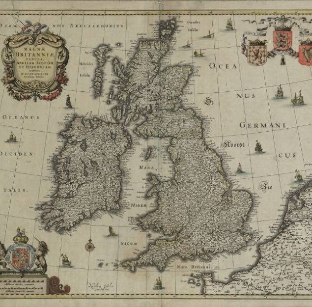
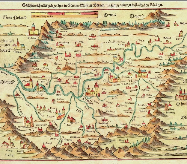
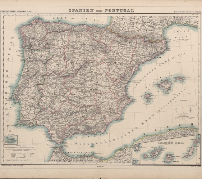
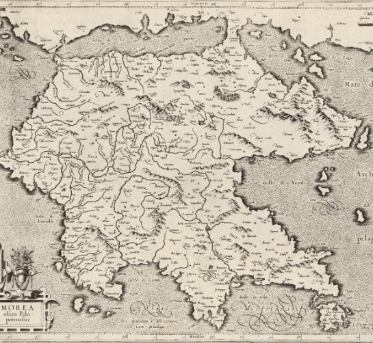
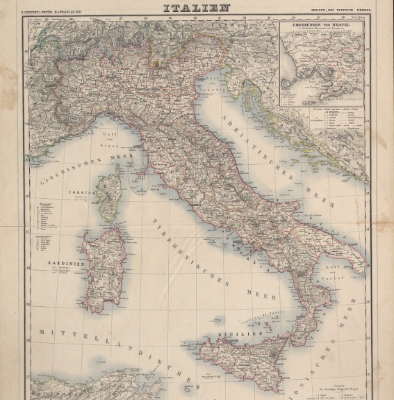
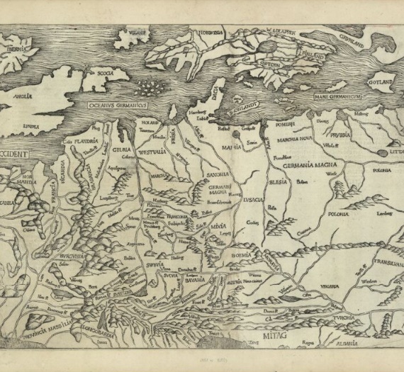
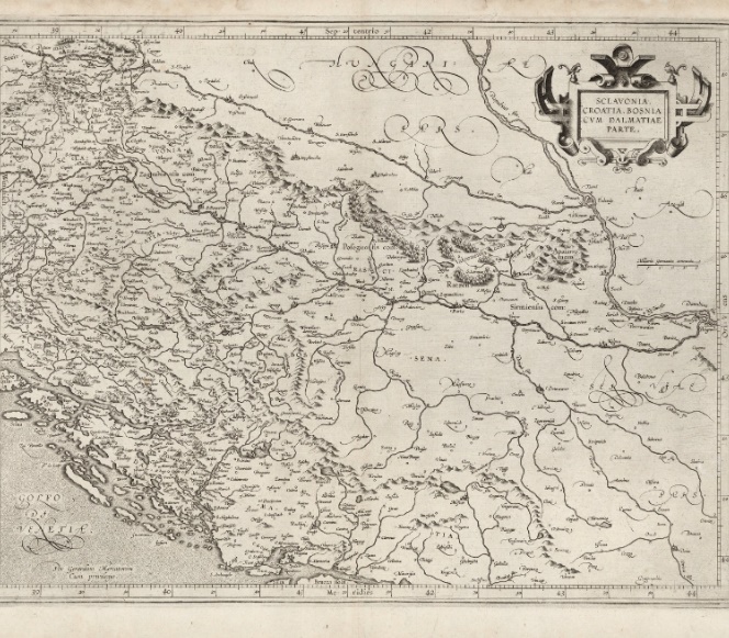
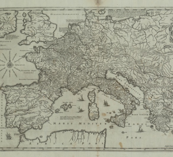
Beginning with the oldest – shared by the National Digital Library POLONA – it is a wood engraving, map depicting the territory of central-east Europe between Rhine and the Black Sea, and also Alps, British Islands and Scandinavian Peninsula from 1493, can be found in an old maps catalogue from collection of Emeryk Hutten Czapski. Next ones, a bit newer maps can be seen in among others Silesian Digital Library, where are historic cooper engravings from 1595, created by Gerarda Mercator: Dalmatia, Bosnia, Croatia and Pelopponese Peninsula. The same repository shared also a very interesting and detailed map of Bretaigne from 17th century. A few older maps can also be found in the Digital Library of Zielona Góra – unusual, 16th century colourful map of Silesia – wood engraving showed up in the work of Sebastian Münster “Kosmografia”, whereas the landshape depicted by little barrows; apart from that – two 19th century German maps of west-southern Europe – Italy and Spain and Portugal.
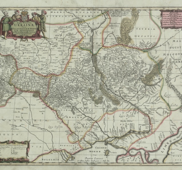
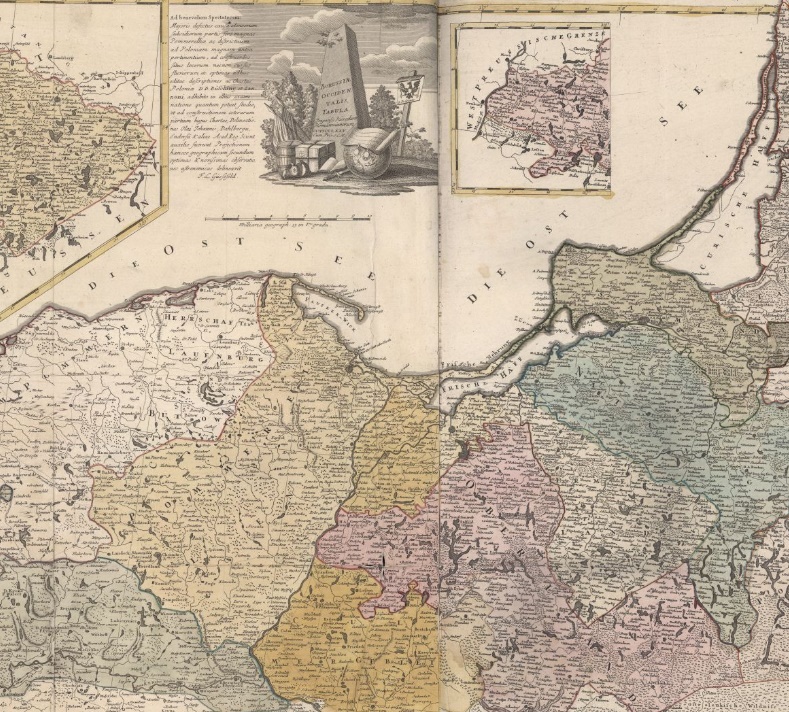
17th century maps can be found in the Kujawsko-Pomorska Digital Library – there are cooper engravings with areas of Ukraine, Great Britain and expansive empire of Carol The Great. Next century is represented by the Digital Library of Opole – there are for example: a manually coloured copperplate with terrains of Prussia, very detailed map of Polish cities in German version; and a bit of Scandinavia – kingdom of Sweden with its coast. Last maps we would like to recommend are already 20th century, just to compare the earlier division of the continent to the pre-war version and the most common for us – the modern one: in the Central Judaika Database it is a colored map showing political situation in Europe in 1921, and in the DIgital Repository of Scientific Institutes we have map of Poland and its neighbourhood from 1919, where borders of designed voievodeships and plebiscite district in Upper Silesia are marked.